The Coldest Place on Earth

By Anupum Pant

A couple of days back I wrote about the hottest place on earth. That made me think of how cold the coldest place would be. I was sure it’d be somewhere in one of the poles, but I wasn’t sure where exactly it was.

This is what Google said:

Aerial photograph of Vostok Station, the coldest directly observed location on Earth. The lowest natural temperature ever directly recorded at ground level on Earth is −89.2 °C (−128.6 °F; 184.0 K), at the Soviet Vostok Station in Antarctica, on July 21, 1983.

After a little more digging, I found that his was the old record. Turns out, the coldest place on earth now, not counting the laboratories, is still in the high ridges of the East Antarctic plateau close to Vostok station. It’s called the Dome B. And the coldest times happen when all the conditions are perfect.

When the conditions are right, the temperatures during winters can reach minus 92 degrees Celsius!

Blood Falls – A Strange Place Home to Strange Creatures

By Anupum Pant

Red colored water, which gives it name blood falls, emerges continually from the edge of a glacier in east Antarctica. The source of this red-colored-water is said to be a lake that is buried 400 meters under a glacier. The water of this lake is extremely salty and is about 3 times saltier than sea water. It is so salty that even at temperatures that Antarctica experiences, it doesn’t freeze. The lake is estimated to be around 5 million years old!

5 million years ago, this part of Antarctica was under sea water. Gradually glaciers started collecting around and over the lake. This made the water body isolated from the main sea and it became a lake eventually. Over time, as it got separated – like the Taal lake – it grew saltier (Taal lake got isolated too, but it turned less saltier). With this lake, the organisms living in it got trapped in this natural time capsule too.

What gives it the color red?

The falls are not red due to some mysterious spores that were found in the red rains of Kerala. What gives it that color, is a popular chemical phenomenon – iron rust.

The lake gets its supply of iron from the bedrock below it. As the water leaks out from the edge, the iron present in water gets oxidized. This oxidized or rusted iron gives the water its red color.

And since the lake has almost no supply of oxygen from around it, the water underneath is probably still like…water – not red (I’m not sure about it).

But that isn’t even anything interesting I’ve talked about the blood falls yet. The most incredible thing is the creatures that have been found living in those waters.

For millions of years, in the extremely salty waters of the lake with almost no oxygen or sun light, scientists have found a kind of micro-organism that has survived there. The kind of process they use to live has dazed scientists.

The microbes living there have been surviving on iron and sulfur! By breaking sulfates to get oxygen. And iron has been restoring the sulfates. It is a beautiful cycle that has never been seen anywhere else. This strange cycle has widened our view on how life could exist on other planets without oxygen in native state.

Source – SciShow by Hank Green.

Enhanced by Zemanta

Gamburtsev Mountain Range – The Unexplored

By Anupum Pant

Unexplored

First, think of something that is 1,200 km in length, 3000 m in height and yet it is complete buried under the Antarctic ice. A whole mountain range called the Gamburtsev Mountain Range in Antarctica has remained unexplored, buried for centuries under a 2 to 4 kilometer thick sheet of ice. The range is named after Grigoriy A. Gamburtsev – a Russian geophysicist.

It amazes me how something of the size of European Alps, right here on earth, has remained unexplored for decades. Scientists estimate that these mountains are several millions of years old. But, till date they have no concrete idea on how they were actually formed.

In the words of Robin Bell, a geophysicist at Columbia University:

Amazingly, we have samples of the moon but none of the Gamburtsevs’.

Discovery: year 1958

In the year 1958, these mountains were discovered by a Soviet expedition. For exploration, this expedition investigated the surface using seismic sounding at around 10 points. During this time, not much detail was known.

Year 2000: It was only in the year 2000 that a project by British Antarctic Survey was able to produce a fairly detailed 3D map of Antarctica to date. As a result, some more information about these mountains was gathered. Still, it wasn’t enough for finding out their origins.

To solve the mystery of their origins, in the year 2011, aircrafts equipped with radars, lasers and various other meters were sent out by researchers to image the last unexplored mountain range on earth. They flew a distance of around 3 times the earth’s circumference over Antarctica – about 120,000 kilometers.
In the end, this flying around returned good results.

This Image gives you a rough idea about how deep these mountains are buried. [PDF]

I hope that in the coming years, scientists will be able to drill through the ice that has accumulated there for millions of years. And then, probably they’ll be able to retrieve real Gamburtsev rock samples for detailed investigation.

Note: Pardon me if I’ve been writing too much in the “Earth” category for the past few days. Trust me it is just a coincidence. In my defense, It is completely possible that a truly random die roll can land 6 consecutive 6s.

The Feynman point is one such example. It is a sequence of 6 nines somewhere in the decimal digits of pi. In short, you cursing me for writing under the same category for the past few days is not justified, logically.

Feynman point

The Standard World Map is Misleading

by Anupum Pant

Mercator’s projection

Most of us have this image of the world in our minds. This kind of a map, today printed in almost every textbook, known as the Mercator’s projection was first created to make work easy for navigators. Even Google Maps uses a Mercator-derived technique to project the world on a flat surface. But, Mercator’s projection has only deceived our idea of geographical area for all these years. For instance, it has led us into believing that Greenland covers an area which is almost equal to Africa (Also, have a look at the size of Antarctica there. Gosh!). The comparison of these two land masses actually looks like this.

According to this infographic, the actual size of Africa is larger than US, China, India, Mexico, Peru, France, Spain, Papua New Guinea, Sweden, Japan, Germany, Norway, Italy, New Zealand, the UK, Nepal, Bangladesh and Greece, all of them put together. In short, Africa is around 14 times larger than Greenland. Do not underestimate its area.

You can try playing with various combinations on this web app – map fight. Try these: Australia vs. Antarctica; US (contiguous) vs. Russia; and of course Greenland vs. Africa; they’ll leave you spellbound.

Why does this happen?

Since our planet is a sphere (an oblate ellipsoid really), to project it on a flat surface like paper, the actual shapes and sizes of landmasses have to be distorted to some extent. There is no way around it. Today, hundreds of different projection methods meant for various purposes are available, but none of them can exactly show the actual shapes & sizes of the landmasses. Some preserve the shape, some preserves the size, and others preserve direction…so on…

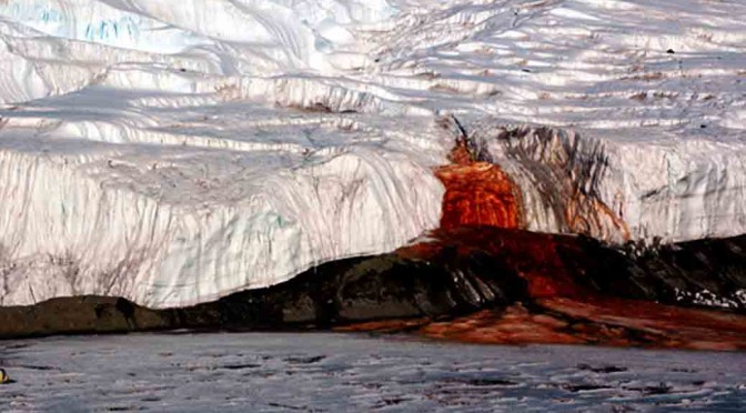
Mercator’s projection, the devious one discussed above, for example, uses a cylindrical projection. That means, it stretches the areas on a globe, which are nearer to the poles. Hence, the imprecise size of Greenland and Antarctica.

What is a perfect map, then?

Even after developing hundreds of projection method, we haven’t been able to spot the perfect method, nor will it happen in the future. But, to get the right sense of area, a projection method known as the Peters (also known as Gall-Peters projection) projection, is said to be the most accurate (in terms of area). It is also one of the most controversial maps.

Peter’s projection also has a huge fan following in spite of its terrible appearance.

Bonus Map Facts:

  1. National Geographic started using the, good looking, Robinson projection from the year 1988, and used it for ten years, then, it moved to the Winkel-Tripel in 1998.
  2. An ideal Mercator’s projection would have infinite height if it doesn’t truncate some area near the extreme poles.
  3. Peters pointed that the Mercator’s projection made developing countries seem much smaller than they actually are. He said that these errors made the struggles of developing nations near the equator looks much smaller to the developed world.
  4. XKCD published a comic on projections – “What your favorite map projection says about you.” 977. [see the explanation here]